Development and Application of Geospatial Tools for Conservation Planning and Delivery


Webinar Details
When:
Jan 15, 2013 2:00 pm US/Eastern
Length: 01:28 (hh:mm)
Advance Registration NOT required.
View now on-demand.
Reviewed for Continued Content Relevance: 06/2016
Presenter(s):
- Richard Weber, Wetland Hydraulic Engineer, USDA NRCS Central National Technology Support Center, National Wetland Team, Fort Worth, TX
- Dwain Daniels, GIS Specialist, USDA NRCS, Central National Technology Support Center, Fort Worth, TX
- Casey Shrader, State Biologist, USDA NRCS, Lexington, KY
CEU Credits/Certificate Offered:
- Certificate of Participation
- Conservation Planner (CP) - 1.5 hour Conservation Planning Credit
Virtual Event Format:
Group Viewing Available:
This webinar demonstrates application of a specific geospatial tool, describes the process that was followed in development of the tool, indicates other potential uses of such tools, and identifies resources available to assist with development of new geospatial tools.
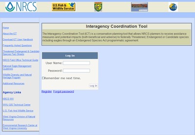
Use of geospatial tools is essential for effective conservation planning and delivery at the landscape level. The USDA NRCS in West Virginia (NRCS-WV), for example, has developed in partnership with the U.S. Fish and Wildlife Service a practical, web-based GIS tool for use by field offices to comply with the Endangered Species Act (http://www.mapwv.gov/ict). In this webinar, the presenters describe the process that NRCS-WV and partners followed to develop and implement the tool. They also demonstrate the potential use of soils and elevation data to define planning units based on ecological parameters. The approach described in this presentation to identify bog turtle habitat is based on the hydrogeomorphic landscape classification system, but can be applied to other landscape definitions including Ecological Site Descriptions and floodplains.
This webinar is sponsored by the USDA NRCS Central National Technology Support Center.